

Snow Creek and Deer Creek High
The creek I surveyed in 2022, and the high school built beside it.
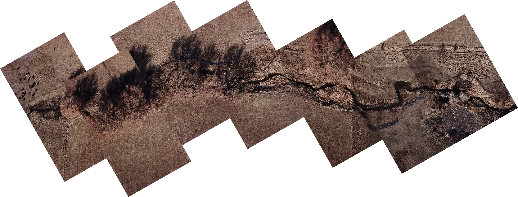
In high school I was the drone specialist on a Wasatch CAPS team working with the Utah Department of Natural Resources. In November 2022 I flew the creek on the west edge of Heber City, on the land where Deer Creek High School was about to go up, stitched the photos into one mosaic, 10,000 by 15,000 pixels, and drew the corridor we surveyed. Our aerial surveys helped save a stand of century-old willows during construction. Below, my mosaic sits on satellite photos of the same ground from before, during and after the build.
- Wasatch CAPS and the Utah Department of Natural Resources
- Drone specialist
- Heber City, Utah


Before construction November 2021
Satellite photos: Esri World Imagery Wayback (Maxar, November 2021 and October 2024; Vantor, July 2025). Creek lines: © OpenStreetMap contributors.
The willows
The willows are still there. In the October 2024 photo, with the buildings going up on both sides, the construction stops short of the creek and leaves a strip of trees and water between the two sites. Slide the construction photo in and out over the willow outline to see it.
- November 2021 Pasture and hay fields, the creek, and the willow stand along its south bank.
- November 2022 My drone survey of the creek corridor, with the leaves off.
- May 2023 Construction starts. KPCW
- October 2024 Both building sites are up, with the willows and the creek left between them.
- July 2026 Deer Creek High School opens. KPCW
How the mosaic was placed
- The photos are Esri World Imagery as it stood on each date, from the Wayback archive, all at about 45 cm per pixel. Lined up against each other, they agree to within 2 m.
- My mosaic has no GPS tags, so I placed it by hand from two landmarks it shares with the 2021 photo: the west end of the willow row and a lone big tree to its east. They're 192 m apart in both. That puts the mosaic at about 2.4 cm per pixel, about 240 by 360 m of ground, turned about 120° from north. The tree shadows check it: they fall to the north, where a November sun puts them.
- The survey boundary is the magenta line I drew around the corridor on the mosaic, moved onto the map with it.
- The willow outline traces the dark crowns along the creek in a summer photo from before construction. The creek lines are from OpenStreetMap.
- I used Claude (Anthropic's AI model) to help line up the layers; the survey and the mosaic are mine.
I'm happy to talk about any of this.
Write to me